
Файл:Relief Map of Franz Josef Land.png
Нæй ын стырдæр фæлтæр .
Relief_Map_of_Franz_Josef_Land.png (600 × 427 пикселы, файлы уæз: 403 КБ, MIME тип: image/png)
Ацы файл у ВикиКъæбицæй ист. Йæ урдыгон афыст у æвдыст дæлдæр. ВикиКъæбиц у сæрибар медиа файлты репозиторий. Дæ бон у баххуыс кæнай. |
Афыст:
| Æмбарынгæнæн |
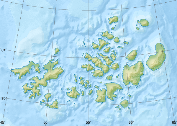
Русский: Физическая карта -- Земля Франца-Иосифа, Россия.
|
| Датæ | |
| Равзæрæн |
|
| Сфæлдисæг | Nzeemin |
| Æндæр фæлтæртæ |
|

Лицензи
Я, владелец авторских прав на это произведение, добровольно публикую его на условиях следующей лицензии:
Этот файл доступен по лицензии Creative Commons Attribution-Share Alike 3.0 Unported.
- Дæ бон у:
- делиться произведением – копировать, распространять и передавать данное произведение
- создавать производные – переделывать данное произведение
- При соблюдении следующих условий:
- атрибуция – Вы должны указать авторство, предоставить ссылку на лицензию и указать, внёс ли автор какие-либо изменения. Это можно сделать любым разумным способом, но не создавая впечатление, что лицензиат поддерживает вас или использование вами данного произведения.
- распространение на тех же условиях – Если вы изменяете, преобразуете или создаёте иное произведение на основе данного, то обязаны использовать лицензию исходного произведения или лицензию, совместимую с исходной.
Файлы истори
Ныххæц датæ/рæстæг-ыл, цæмæй фенай еуæд куыд фæзындис.
| Датæ/рæстæг | Къаддæргонд | Барæнтæ | Архайæг | Фиппаинаг | |
|---|---|---|---|---|---|
| нырыккон | 09:41, 17 октябры 2018 | | 600 × 427 (403 КБ) | RosssW | Полуостров стал островом https://ru.wikipedia.org/wiki/Остров_Юрия_Кучиева |
| 17:57, 15 майы 2012 |  | 600 × 427 (374 КБ) | Nzeemin | bathymetry interpolated | |
| 08:50, 7 апрелы 2012 |  | 600 × 427 (251 КБ) | Nzeemin | frame removed | |
| 19:14, 17 мартъийы 2012 |  | 600 × 427 (251 КБ) | Nzeemin | plus bathymetry | |
| 19:57, 10 мартъийы 2012 |  | 600 × 427 (95 КБ) | Nzeemin |
Файлæй архайд
Ацы файлæй пайда кæнынц ахæм фæрстæ:
Ацы файлæй куыд пайда кæнынц
Данный файл используется в следующих вики:
- Использование в az.wikipedia.org
- Использование в be.wikipedia.org
- Использование в cs.wikipedia.org
- Использование в de.wikipedia.org
- Hayes-Insel
- Wilczek-Insel
- Wilczekland
- Rudolf-Insel
- Graham-Bell-Insel
- Hall-Insel (Franz-Josef-Land)
- Alexandraland
- Prinz-Georg-Land
- Koldewey-Insel
- Wiener-Neustadt-Insel
- Hohenlohe-Insel
- Northbrook-Insel
- Hooker-Insel
- Eva-Liv-Insel
- Jackson-Insel
- Champ-Insel
- Alger-Insel
- Vorlage:Positionskarte Franz-Josef-Land
- Ziegler-Insel
- Salisbury-Insel
- McClintock-Insel
- Perlmutt-Insel
- Arthur-Insel
- La-Ronciere-Insel
- Bell-Insel
- Mabel-Insel
- Becker-Insel
- Greely-Insel
- Salm-Insel
- Kane-Insel
- Kuhn-Insel (Franz-Josef-Land)
- Karl-Alexander-Insel
- Hoffmann-Insel
- Lütke-Insel
- Brosch-Insel
- Hochstetter-Inseln
- Luigi-Insel
- Bruce-Insel
Просмотреть глобальное использование этого файла.