
Файл:Hauts-de-Seine department relief location map.jpg
Къаддæргонды ас: 355 × 599 пикселы Другие разрешения: 142 × 240 пикселы | 284 × 480 пикселы | 823 × 1389 пикселы.
Оригиналы файл (823 × 1389 пикселы, файлы уæз: 228 КБ, MIME тип: image/jpeg)
Ацы файл у ВикиКъæбицæй ист. Йæ урдыгон афыст у æвдыст дæлдæр. ВикиКъæбиц у сæрибар медиа файлты репозиторий. Дæ бон у баххуыс кæнай. |
Афыст:
| Местоположение камеры | | Это и другие изображения по их местоположению на OpenStreetMap |
|---|
| Æмбарынгæнæн |
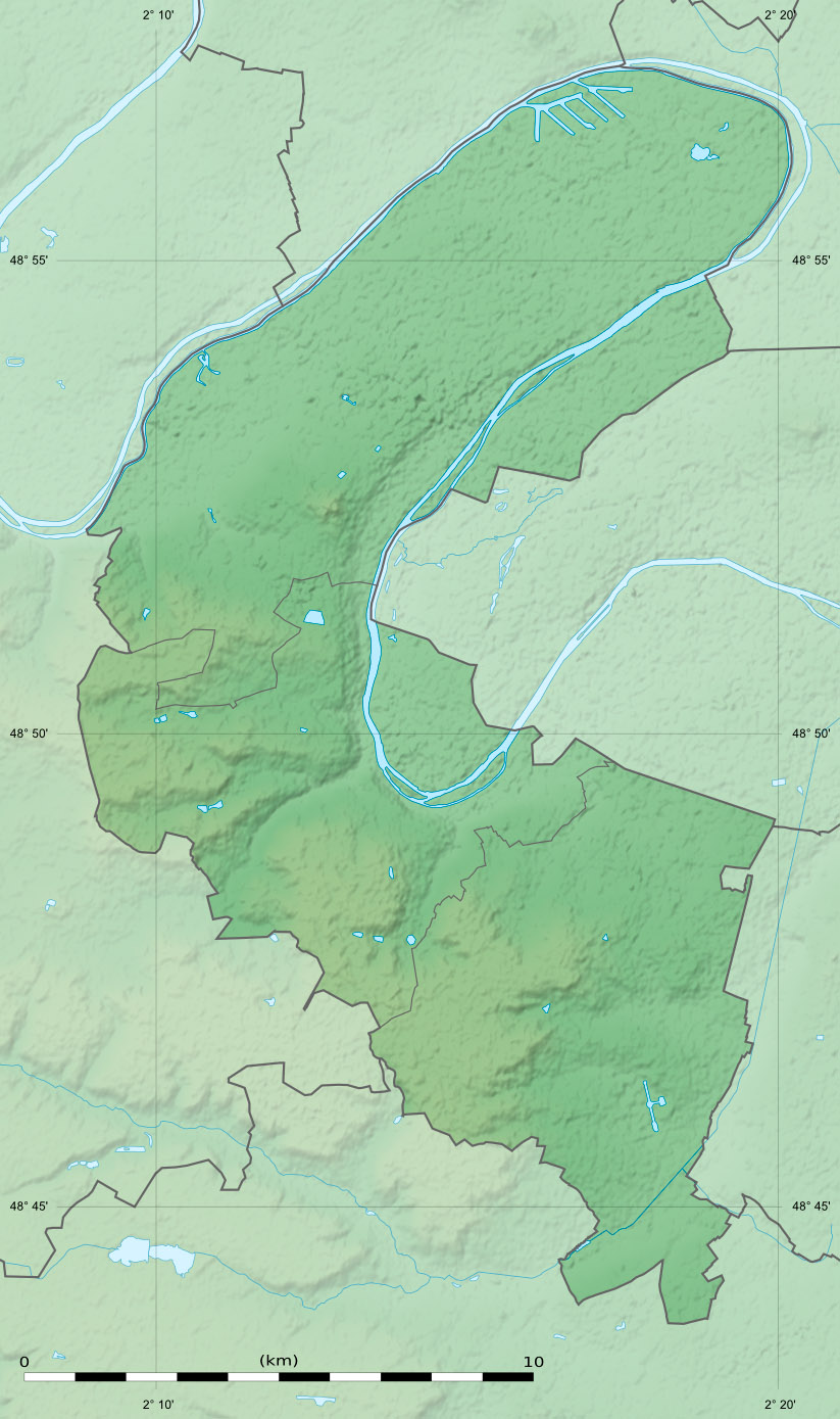
English: Blank physical map of the department of the Hauts-de-Seine, France, as in January 2015, for geo-location purpose, with distinct boundaries for departments and arrondissements.
Français : Carte physique vierge du département des Hauts-de-Seine, France, tel qu'en janvier 2015, destinée à la géolocalisation, avec limite distincte des départements et arrondissements. Scale:
Equirectangular projection, WGS84 datum
Geographic limits of the map:
|
||
| Датæ | |||
| Равзæрæн |
Хи куыст
|
||
| Сфæлдисæг | Eric Gaba (Sting - fr:Sting) | ||
| Бар (Ацы файлæй ног архайд) |
|
||
| Æндæр фæлтæртæ |
|

Лицензи
Eric Gaba, Wikimedia Commons user Sting, владелец авторских прав на это произведение, добровольно публикует его на условиях следующей лицензии:
Этот файл доступен по лицензии Creative Commons Attribution-Share Alike 3.0 Unported.
Атрибуция: Eric Gaba, Wikimedia Commons user Sting
- Дæ бон у:
- делиться произведением – копировать, распространять и передавать данное произведение
- создавать производные – переделывать данное произведение
- При соблюдении следующих условий:
- атрибуция – Вы должны указать авторство, предоставить ссылку на лицензию и указать, внёс ли автор какие-либо изменения. Это можно сделать любым разумным способом, но не создавая впечатление, что лицензиат поддерживает вас или использование вами данного произведения.
- распространение на тех же условиях – Если вы изменяете, преобразуете или создаёте иное произведение на основе данного, то обязаны использовать лицензию исходного произведения или лицензию, совместимую с исходной.
Файлы истори
Ныххæц датæ/рæстæг-ыл, цæмæй фенай еуæд куыд фæзындис.
| Датæ/рæстæг | Къаддæргонд | Барæнтæ | Архайæг | Фиппаинаг | |
|---|---|---|---|---|---|
| нырыккон | 15:36, 12 февралы 2015 | | 823 × 1389 (228 КБ) | Sting | Boundaries correction |
| 22:40, 23 январы 2015 |  | 823 × 1389 (302 КБ) | Sting | == {{int:filedesc}} == {{Location|48|50|15|N|02|14|15|E|scale:300000}} {{Information |Description={{en|Blank physical map of the department of the Hauts-de-Seine, France, as in January 2015, for geo-location purpose, with distinc... |
Файлæй архайд
Ацы файлæй пайда кæны иу фарс:
Ацы файлæй куыд пайда кæнынц
Данный файл используется в следующих вики:
- Использование в als.wikipedia.org
- Использование в de.wikipedia.org
- Использование в eo.wikipedia.org
- Использование в frr.wikipedia.org
- Использование в fr.wikipedia.org
- Boulogne-Billancourt
- Colombes
- Asnières-sur-Seine
- Courbevoie
- Clamart
- Chaville
- Clichy
- Meudon
- Antony
- Issy-les-Moulineaux
- Levallois-Perret
- Gennevilliers
- Puteaux
- Sèvres
- Bagneux (Hauts-de-Seine)
- Bois-Colombes
- Bourg-la-Reine
- Châtenay-Malabry
- Garches
- La Garenne-Colombes
- Malakoff (Hauts-de-Seine)
- Marnes-la-Coquette
- Saint-Cloud
- Vanves
- Vaucresson
- Villeneuve-la-Garenne
- Île Saint-Germain
- Île Seguin
- Île de la Jatte
- Bataille de Buzenval (1871)
- Forêt de Fausses-Reposes
- Neuilly-sur-Seine
- Suresnes
- Mont Valérien
- Géographie des Hauts-de-Seine
- Forêt de Meudon
- Île de Puteaux
- Sceaux (Hauts-de-Seine)
- Rueil-Malmaison
Просмотреть глобальное использование этого файла.