
Файл:Croatia Zadar County adm location map.svg

Оригиналы файл (SVG файл, номиналон 1467 × 1031 пикселы, файлы бæрц: 729 КБ)
Ацы файл у ВикиКъæбицæй ист. Йæ урдыгон афыст у æвдыст дæлдæр. ВикиКъæбиц у сæрибар медиа файлты репозиторий. Дæ бон у баххуыс кæнай. |
Афыст:
| Æмбарынгæнæн |
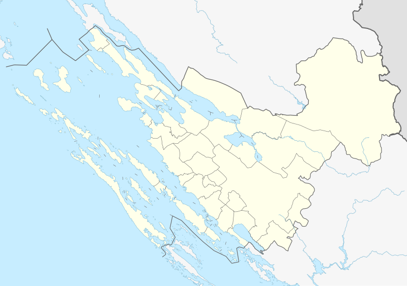
Deutsch: Positionskarte der Gespanschaft Zadar, Kroatien
English: Location map of Zadar County, Croatia
|
||||||||||||
| Датæ | |||||||||||||
| Равзæрæн |
Собственная работа, используя: |
||||||||||||
| Сфæлдисæг | NordNordWest and OpenStreetMap contributors | ||||||||||||

|
Эта карта была улучшена в немецкой Kartenwerkstatt. Вы можете также предложить другие карты для улучшения.
|
Лицензи
Usage of this file with:

explanatory notes: Legally binding is only the full legalcode. For a free usage I recommend to respect the following licence conditions:
1. Provide my name as given above: NordNordWest,
2. a copy of, or the URI for, the applicable license: https://creativecommons.org/licenses/by-sa/3.0/de/legalcode,
3. the title of the work,
4. in the case of an adaptation, a credit identifying the use of the work in the adaptation.
This license and the rights granted hereunder will terminate automatically upon any breach by you of the terms of this license. Any of the above conditions can be waived if you get permission from the copyright holder. If you have questions or wish differing conditions, please contact me through nnwest or my discussion page ![]() t-online.de
t-online.de
- Дæ бон у:
- делиться произведением – копировать, распространять и передавать данное произведение
- создавать производные – переделывать данное произведение
- При соблюдении следующих условий:
- атрибуция – Вы должны указать авторство, предоставить ссылку на лицензию и указать, внёс ли автор какие-либо изменения. Это можно сделать любым разумным способом, но не создавая впечатление, что лицензиат поддерживает вас или использование вами данного произведения.
- распространение на тех же условиях – Если вы изменяете, преобразуете или создаёте иное произведение на основе данного, то обязаны использовать лицензию исходного произведения или лицензию, совместимую с исходной.

Файлы истори
Ныххæц датæ/рæстæг-ыл, цæмæй фенай еуæд куыд фæзындис.
| Датæ/рæстæг | Къаддæргонд | Барæнтæ | Архайæг | Фиппаинаг | |
|---|---|---|---|---|---|
| нырыккон | 18:26, 21 февралы 2023 | | 1467 × 1031 (729 КБ) | NordNordWest | == {{int:filedesc}} == {{Information |description= {{de|1=Positionskarte der Gespanschaft Zadar, Kroatien}} {{en|1=Location map of Zadar County, Croatia}} {{Location map series N |stretching=–|top=44.6219166|bottom=43.7512194|left=14.52025|right=16.2457166}} |Source={{Own using}} * [http://www.openstreetmap.org OpenStreetMap] |date=2023-02-21 |author={{U|NordNordWest}} and OpenStreetMap contributors |other fields= }} {{Kartenwerkstatt}} == {{int:license-header}} == {{User:NordNordWest/Licenc... |
Файлæй архайд
Ацы файлæй пайда кæнынц ахæм фæрстæ:
Ацы файлæй куыд пайда кæнынц
Данный файл используется в следующих вики:
- Использование в de.wikipedia.org
- Molat
- Premuda
- Pašman
- Olib
- Dugi Otok
- Ugljan
- Iž
- Vir (Insel)
- Rivanj
- Lavdara
- Ist (Insel)
- Srbski Klanac
- Dvorana Krešimira Ćosića
- Rava (Insel)
- Silba
- Sestrunj
- Zverinac
- Vrgada
- Maslenica-Brücke
- Škarda
- Festung Ostrovica
- Pumpspeicherkraftwerk Velebit
- Pag-Brücke
- Maslenica-Autobahnbrücke
- Vorlage:Positionskarte Kroatien Zadar
- Kudin-Brücke
- Использование в fr.wikipedia.org
Просмотреть глобальное использование этого файла.