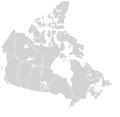
Файл:Canada blank map.svg

Содержимое страницы недоступно на других языках.
Сæрибар энциклопеди Википедийы æрмæг.

Оригиналы файл(SVG файл, номиналон 1114 × 942 пикселы, файлы бæрц: 205 КБ)

Æмбарынгæнæн
English: Blank SVG map of the territory claimed by Canada

Non-contiguous parts of a states/provinces are "grouped" together with the main area of the state/provinces, so any state/provinces can be coloured in completion with one click anywhere on the state/provinces's area.

Also, all states/provinces have a "id" attached to them, making them easy to find. Select "find" and then enter in the state/provinces's ISO 3166-2 code in the "id" field to find it. The codes can be found here.

There are 19 lakes shown; each has an ID that matches its official name. The lakes can be easily be found in the XML tree and they can be individually deleted to make room for text or other overlays.
Датæ 03-07-2007 edited 8-Aug-2007
Равзæрæн
Сфæлдисæг Lokal_Profil image cut to remove USA by Paul Robinson
Бар
(Ацы файлæй ног архайд)
Public domain This map is ineligible for copyright and therefore in the public domain, because it consists entirely of information that is common property and contains no original authorship. For more information, see Commons:Threshold of originality § Maps.

English | Español | Galego | Română | slovenščina | العربية | 中文 | +/−

Æндæр фæлтæртæ

Производные работы от этого файла:

Canada Labelled map.svg this map with province labels
Original blank map of USA and Canada, That image with labels,

Original USA/Canada map with labels
SVG‑разработка
InfoField
 
Исходный код этого SVG-файла корректен.
 
Это map было создано с помощью Inkscape.

Краткие подписи

Добавьте однострочное описание того, что собой представляет этот файл

Элементы, изображённые на этом файле

изображённый объект уырыссаг

MIME-тип уырыссаг

image/svg+xml

3a165ea2ae3683659891b4c139a0f466e71efb69

метод определения уырыссаг: SHA-1 уырыссаг

размер данных уырыссаг

209 532 байт

высота/рост уырыссаг

942 пиксель

ширина уырыссаг

1114 пиксель

Файлы истори

Ныххæц датæ/рæстæг-ыл, цæмæй фенай еуæд куыд фæзындис.

Датæ/рæстæгКъаддæргондБарæнтæАрхайæгФиппаинаг
нырыккон23:30, 16 ноябры 2020Къаддæргонд уыцы версийæн: 23:30, 16 ноябры 20201114 × 942 (205 КБ)MapGridSync with File:Canada_location_map_2_-_lite.svg
11:43, 5 декабры 2007Къаддæргонд уыцы версийæн: 11:43, 5 декабры 20071304 × 1263 (113 КБ)Lokal ProfilCleaned up code
21:25, 9 августы 2007Къаддæргонд уыцы версийæн: 21:25, 9 августы 20071304 × 1263 (115 КБ)Rfc1394{{Information |Description={{en|Blank SVG map of Canada}} Non-contiguous parts of a states/provinces are "grouped" together with the main area of the state/provinces, so any state/provinces can be coloured in completion with one click anywhere on the stat

Ацы файлæй пайда кæнынц ахæм фæрстæ:

Ацы файлæй куыд пайда кæнынц

Данный файл используется в следующих вики:

Метабæрæггæнæнтæ